Scroll to Top
SKIP TO PAGE CONTENT
The Texas General Land Office
Commissioner Dawn Buckingham, M.D.
Facebook
Twitter
Instagram
Pinterest
Youtube
Medium
1.800.998.4GLO (4456)
Search the website
HOME
THE GLO
ABOUT THE GLO
Overview
The Commissioner
GLO EVENTS
Event Calendar
Webcasts
PUBLIC INFORMATION
Public Information Request
Public Notices
GLO NEWS
Press Releases
Editorials
Newsletters
REPORTS
Audit & Legislative
Budget
JOBS AT THE GLO
Career Opportunities
ONLINE PAYMENTS
Payments Page
BOARDS & COMMISSIONS
School Land Board
Veterans Land Board
Coastal Coordination Advisory Committee
Board for Lease: Texas Parks & Wildlife Department
Board for Lease: Texas Department of Criminal Justice
Board for Lease: University Lands
Texas State Veterans Cemetery Committee
Special Board of Review
DOING BUSINESS WITH THE GLO
Procurement
Historically Underutilized Businesses (HUB)
EDUCATION
ENERGY
ENERGY BUSINESS
Overview
SUSTAINABILITY INITIATIVE
Overview
Methane Policy
Dark Skies Initiative
VETERANS
HERITAGE
GLO ARCHIVES
Overview
Map Store
Land Grant Search
Surname Index
Collections
Visit The GLO Archives
Programs & Events
Speaking Request
Services
Forms & Handouts
Books & Collectibles
THE ALAMO
Overview
Involvement
LAND
LAND MANAGEMENT
Overview
Governor’s Report
Real Property Evaluation Reports
Forms
Leasing & Easements
Lease Payments
Surveying
GIS Maps & Data
Field Offices
STATE LAND SALES
VLB Land For Sale
Hobby Building Redevelopment Site
COAST
COASTAL MANAGEMENT
Coastal Planning
Open Beaches
Rollover Pass
Permitting
Leasing & Easements
Forms
Coastal Erosion
Federal Consistency
Programs, Tools & Resources
NRDA
Clean Coast Texas
Living Shorelines
GRANT PROJECTS
Funding Opportunities
Coastal Management Program
Coastal Impact Assistance Program
Coastal Erosion Planning & Response Act
Oil Spill Prevention & Response Research
Grant Projects Listing
OIL SPILL
Overview
Derelict Vessel & DCO Information
Funding Opportunity
Derelict Vessel Notices
Vessel Registration & Vessel Search
Facilities Certification
Oil Spill Toolkit
Forms
Penalty Payment
HURRICANES & TROPICAL STORMS
Hanna
Rebuilding & Repairing Coastal Structures
Laura & Beta
Rebuilding & Emergency Dune Restoration
RECOVERY
CONTACT
LOCATION & HOURS
1700 Congress Ave. Austin, TX 78701-1495
1.800.998.4GLO (4456) // 512.463.5001
8:00 a.m. to 5:00 p.m. Monday - Friday
GENERAL
Agency Directory
Email Us
Compliments / Complaints
Commissioner Request Forms
LOCATIONS
Field Offices
Veterans Homes
State Veterans Cemeteries
Land
Land Management
gis
aerials
2006may
Aerial Imagery & 3D Elevation (LiDAR) Catalog
Aerial Imagery & LiDAR Data
>
2000 - 2009
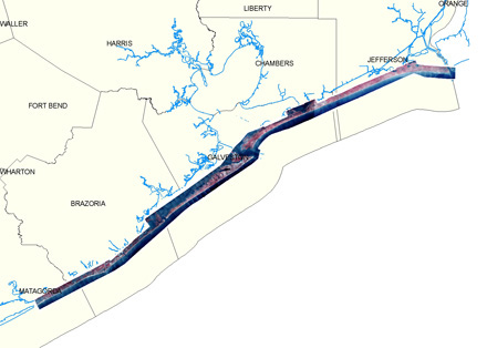
May 2006
| Upper Coast
Click to zoom to an area.