Step One: Online Suitability Evaluation Model
One of the great aspects about living shorelines is that they can do a lot of growing on their own, but they will work best if you select and build the type that is most suited for your situation. While each property is unique and there is not a “one size fits all” living shoreline solution, there are steps you can follow to ensure the right living shoreline is implemented on your property.
This section explains the different living shoreline elements and the site characteristics that they complement, along with tools that can help you in the decision-making process.
A Model to Find the Right Living Shoreline for You
The Texas General Land Office, with the Harte Research Institute at Texas A&M University – Corpus Christi (HRI) and the Galveston Bay Foundation, created the Living Shoreline Site Suitability Model to help users determine if their property is suitable for a living shoreline.
This user-friendly model provides a recommendation on the type of living shoreline best suited for the coastal property address entered. Depending on the property’s location, the model may recommend one of four different living shoreline types. Or, in some situations, a living shoreline might not be suitable at all! The model is as an important first step in planning a living shoreline project.
How to Use the Living Shoreline Site Suitability Model
First, enter your address of interest on the map below. Then, click on the shoreline adjacent to the property’s address. A pop-up window will appear with the recommended living shoreline method and a description of why this method was selected. Note, some properties may not be suitable for a living shoreline based on the model’s prediction.
To further confirm the results of the model, you can evaluate which living shoreline option might be a good fit for your property using the Living Shoreline Site Suitability Decision Tool developed by HRI. This interactive tool asks you a series of "Yes" or "No" questions and ultimately, will arrive at a living shoreline recommendation. The model and the tool are companion pieces and, most of the time, will arrive at the same living shoreline recommendation.
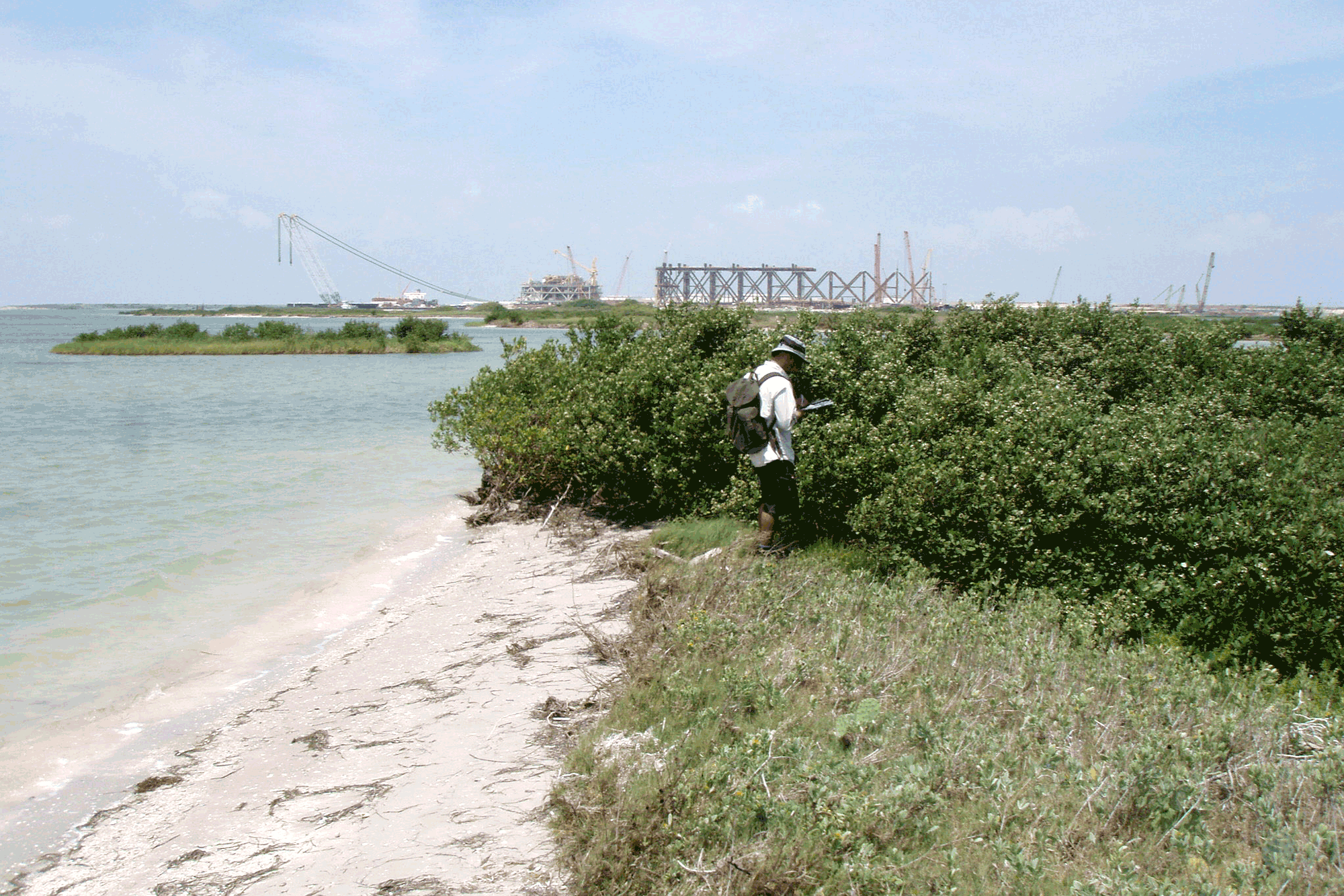
If you need assistance understanding any terms or recommendations, the Visual Site Assessment can be a helpful reference. This document includes definitions and pictures to illustrate shoreline characteristics, such as erosion rate and slope.
It is important to note that the site suitability model and decision tool are not recommended substitutes for a site assessment. These tools only provide a general idea of a living shorelines situatable at a location and we encourage all property owners to continue on to Step 2: Visual Site Assessment.
How the Living Shoreline Site Suitability Model Works
The living shoreline site suitability model was created by integrating the original HRI Living Shoreline Suitability Model and the Galveston Bay Foundation Living Shoreline Protection Model. The model evaluates the following shoreline characteristics to determine which living shoreline option to recommend for a property address:
- shoreline type
- bank height
- nearshore water depth
- wave exposure
- shoreline change rate
- subaquatic vegetation presence
- tidal creek presence
- boat ramp presence
- conservation area presence
- oyster presence
- oyster suitability
- shipping channel presence
The model takes into consideration all the above-mentioned attributes of a stretch of coast to decide which living shoreline option to recommend. The model output is a map whose shoreline is divided into segments and each segment recommends one of five options:
- Soft Stabilization
- Hybrid Stabilization
- Retrofit: Soft Stabilization
- Retrofit: Hybrid Stabilization
- Not suitable
When you click on a shoreline segment, a pop-up will appear with the recommended general living shoreline method as determined by the model and a description of what that method entails. A more detailed explanation of the Living Shoreline Site Suitability Model, including the data selected, is available here.
View larger map.
Keep Exploring
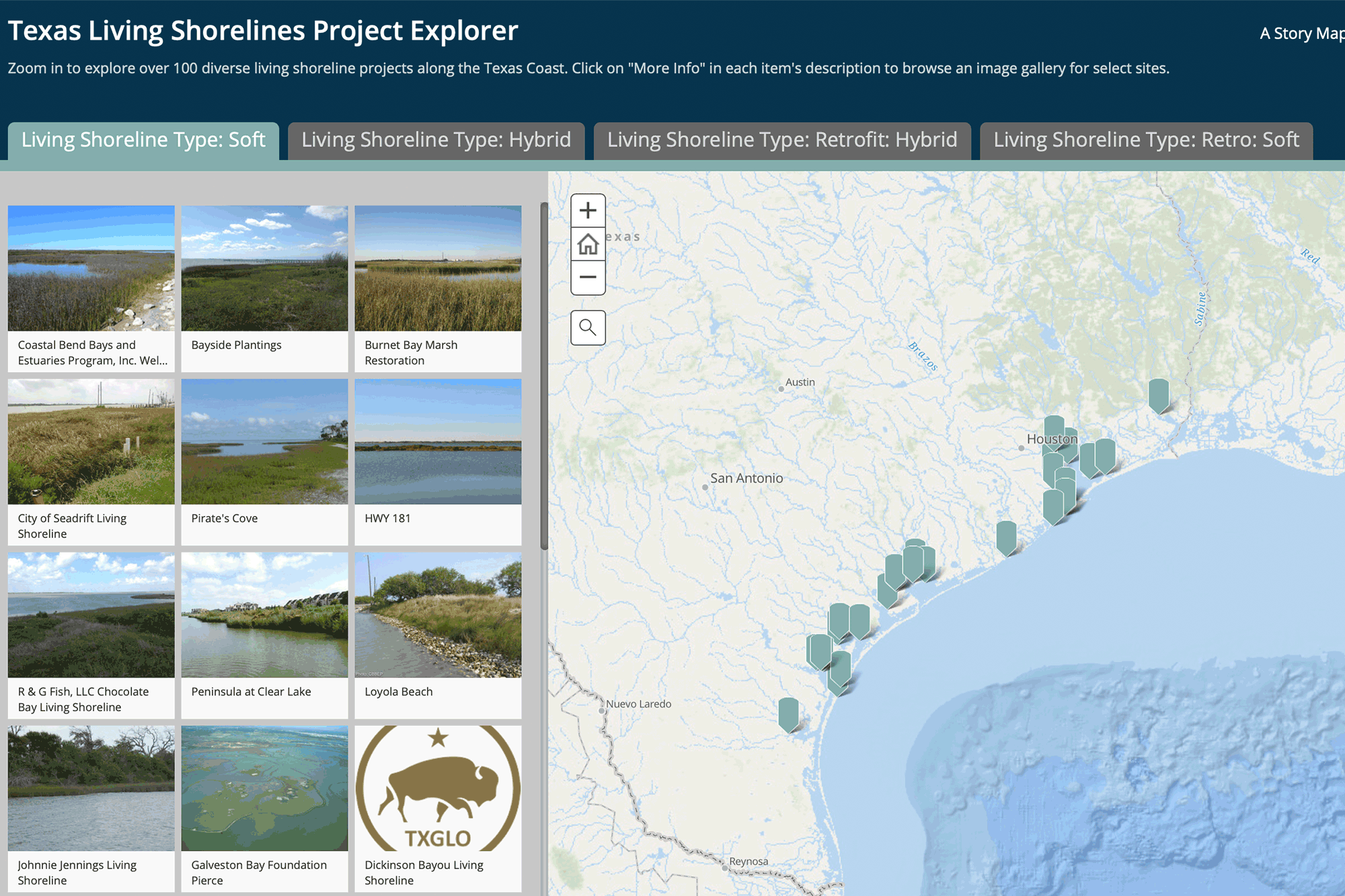
View an interactive map of existing living shorelines in Texas to find examples as well as projects near you for inspiration.
Learn More
For more information on the Site Suitability Model, check out this helpful overview created by Harte Research Institute.
Learn More
Not sure what a term means? We’ve got you covered! Visit our glossary for an extensive list of commonly used terms in coastal management and living shoreline construction.
Learn More