1990 Nueces County
SKIP TO PAGE CONTENT
  • Land
  •  
  • Land Management
  •  
  • gis
  •  
  • aerials

Aerial Imagery & 3D Elevation (LiDAR) Catalog


To request the high-resolution imagery, please send the flight date/name, and the list of your requested tiles, to the General Land Office Geospatial Team at Geospatial@glo.texas.gov or 512-463-4352.

The Texas General Land Office makes no representations or warranties regarding the accuracy or completeness of the information depicted on these images, or the data from which they were produced. These images ARE NOT suitable for navigational purposes and do not purport to depict or establish boundaries between private and public land.
Photo credit: Texas General Land Office.
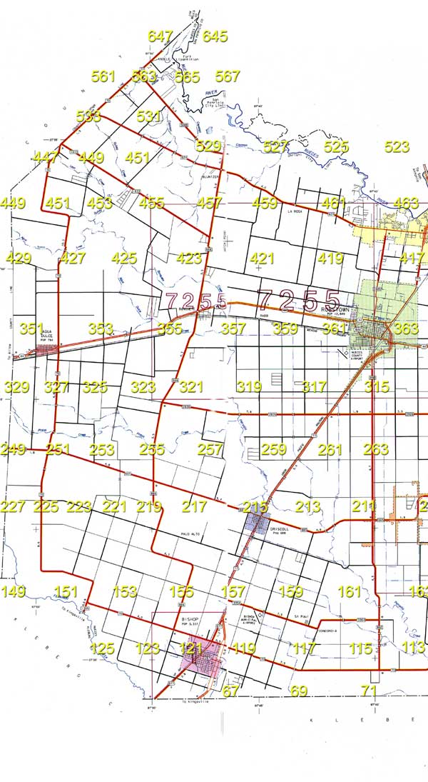
Western Nueces County Frame 211 Frame 209 Frame 149 Frame 151 Frame 153 Frame 155 Frame 157 Frame 159 Frame 161 Frame 163 Frame 125 Frame 123 Frame 121 Frame 119 Frame 117 Frame 115 Frame 113 Frame 67 Frame 69 Frame 71 Frame 647 Frame 645 Frame 561 Frame 563 Frame 565 Frame 567 Frame 533 Frame 531 Frame 529 Frame 527 Frame 525 Frame 523 Frame 449 Frame 451 Frame 449 Frame 451 Frame 453 Frame 455 Frame 457 Frame 459 Frame 461 Frame 463 Frame 429 Frame 427 Frame 425 Frame 423 Frame 421 Frame 419 Frame 417 Frame 351 Frame 353 Frame 355 Frame 357 Frame 359 Frame 361 Frame 363 Frame 327 Frame 325 Frame 323 Frame 321 Frame 319 Frame 317 Frame 315 Frame 249 Frame 251 Frame 253 Frame 255 Frame 257 Frame 259 Frame 261 Frame 263 Frame 227 Frame 225 Frame 223 Frame 221 Frame 219 Frame 217 Frame 215 Frame 213


Format:
Scanned and georeferenced black and white 9"x9" prints
Locations:
Nueces County
Source:
Texas Natural Resource Information System (TNRIS)