


Historically, Texans have turned to the Texas General Land Office for maps and other tools used to display and organize information about the state’s rich natural resources.
Besides historical maps, research, and data, today the Land Office uses Geographic Information Systems (GIS), aerial imagery, 3D elevation data, and field data collection to compile, analyze, and distribute the most accurate geospatial data possible about the location of natural and cultural resources. These tools support the critical business functions of the General Land Office, and are essential for the study and protection of our state's valued resources. This GIS page contains a collection of dynamic, interactive mapping tools that provide access to the vast collection of spatial data available at the agency, as well as download links for our authoritative datasets.
Please contact the Geospatial Team at Geospatial@glo.texas.gov or (512) 463-4352 with questions, comments, concerns.
The Texas General Land Office makes no representations or warranties regarding the accuracy or completeness of the information depicted in these mapping applications, in downloads from this page, or the data from which it was produced. These datasets ARE NOT suitable for navigational purposes and do not purport to depict or establish boundaries between private and public land.
Map Viewers
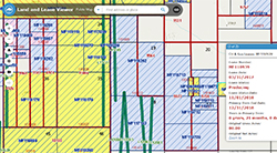
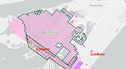
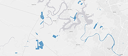
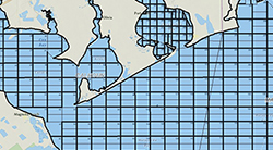
Land and Lease Mapping Viewer
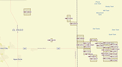
The Land and Lease Mapping Viewer, an interactive mapping application, provides access to vast collections of land- and energy-related data at the General Land Office. The Land and Lease Viewer displays upland and submerged Original Texas Land Survey boundaries, Permanent School Fund land, upland and coastal leases, oil and gas well locations, and current aerial imagery. This version does not require a third-party plugin and is compatible with most mobile devices.
Texas Beach Watch
The goal of the Texas Beach Watch Web application is to provide the public with information about water quality at selected recreational beaches along the Texas coast.
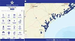
Texas Coasts
Find your perfect beach! From fishing and boat ramps, to camping and BBQ—the Texas coast provides a wealth of resources to all visitors. The GLO is proud to offer this free resource to help you explore all that our shores have to offer.
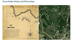
Texas Hidden History
Texans have long turned to the Texas General Land Office (GLO) for maps and other tools used to display and organize information about the state’s rich natural resources. Since 2014, one such GLO initiative is Texas Hidden History (THH), a collaborative project between the GLO’s Archives and Records and Geospatial Technology Services Team. In 2020 the initiative was expanded to use Esri GIS software to produce narrative StoryMaps on Texas History topics that align with GLO collections strengths.
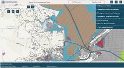
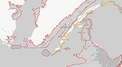
Coastal Resource Management Viewer
Resource Management Codes (RMCs) are assigned to state-owned tracts in Texas bays and the Gulf of America, providing development guidelines for activities within each tract. The codes enhance protection of sensitive natural resources by providing recommendations for minimizing adverse impacts from mineral exploration and development activities. The codes include recommendations from the U.S. Fish and Wildlife Service, National Marine Fisheries Service, Texas Parks and Wildlife Department, Texas Historical Commission, and the U.S. Army Corps of Engineers.
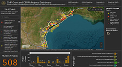
CMP Grant and CEPRA Projects Dashboard
Projects funded by Coastal Management Program (CMP) and Coastal Erosion Planning and Response Act (CEPRA) since 2010.
Texas Coastal Sediments Geodatabase
The Texas Coastal Sediments Geodatabase (TxSed) contains sediment-related geospatial and geotechnical data. TxSed can help identify compatible sediment resources for proposed beach nourishment or habitat restoration projects and can be used as an aid in the permitting/regulatory processes for such projects.
If you would like to contribute data to the Texas Coastal Sediments Geodatabase (TxSed), please email us at txsed@glo.texas.gov.
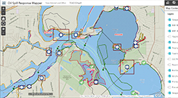
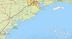
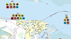
Oil Spill Response Mapping Tool
The Oil Spill Response Mapping Tool contains information from the Oil Spill Toolkit, TGLO coastal resources, and NOAA. Use the provided tools to generate reports for ICS forms, identify sensitive habitats and species, view maritime information, query spatial data, and other mapping activities.
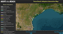
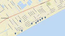
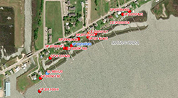
Texas Beach Adopters Map
Adopt a stretch of beach today! Are you committed to helping ensure Texas beaches are trash-free? Then consider adopting one! Our adopters pledge to clean a designated stretch of Texas coastline, a minimum of three times a year for two years. Many adopters are long-time stewards of Texas beaches and renew their membership year after year. With this interactive map, learn which stretches of Texas beach are available for adoption.
GIS Data Downloads
Aerial Imagery and LiDAR Data
The Aerial Imagery and LiDAR Data Collection provides low-resolution catalogs of flights from 1938 to the present, for various areas within the Coastal Zone. For the high-resolution images, contact the General Land Office.
Beach Access Points
Public beach access points mapped by the GLO, in cooperation with coastal cities and counties.
Coastal Leases (Points)
Locations of structures and activities permitted by the GLO within state-owned land and waters. Includes features represented by a single point location, such as piers, docks, breakwaters, and shoreline protection projects.
Coastal Leases (Polygons)
Locations of structures and activities permitted by the GLO within state-owned land and waters. Includes areal features such as dredging areas, parks, mitigation projects, and conservation easements.
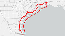
Coastal Zone Boundary
The official boundary of the Texas Coastal Management Program (CMP). The area lying generally seaward of the coastal facility designation line, which is the line adopted under the Oil Spill Prevention and Response Act of 1991, to describe areas where oil spills are likely to enter tidal waters. The layer also includes wetlands landward of the coastal facility designation line, generally within one mile from the shoreline, along the extreme inland reach of certain tidal rivers and streams.
Dispersant Use Pre-Approval Zone
Boundaries of pre-approved area for use of dispersant in oil spill response. Boundaries were created by combining the 10-meter offshore bathymetric contour and the three nautical mile line. The boundary follows whichever line is farthest offshore. Data are not to be used for navigation or for mapping at large scales.
Environmental Sensitivity Index Shoreline
Shoreline of Texas with sensitivity classification of habitats to oil contamination and removal. Classification conducted by the University of Texas Bureau of Economic Geology.
Hard Mineral Leases
Contains basic information about active Hard Mineral Leases (minerals other than oil and gas) issued by or through the General Land Office. The information in this layer represents a snapshot in time. As new leases are added, expired, or terminated, they are removed from the active layer.
In-Situ Burn Exclusion Areas
Areas, designated by the Oil Spill Regional Response Team VI, where in-situ burns are prohibited.
Miscellaneous Easements
Easements for pipelines, power lines, bridges, and other miscellaneous infrastructure located on state-owned upland and submerged lands.
Navigation Districts
Submerged lands granted with mineral reservations by the Texas legislature to Navigation Districts.
Offshore Oil and Gas Structures
Oil and gas platforms or wells that are above the waterline, located in GLO-managed waters (bays or the Gulf of America). Data includes, location, type, and GLO site number.
Oil and Gas Leases
Oil and Gas Leases managed by the Texas General Land Office.
Oil and Gas Units
Oil and Gas pooling agreements managed by the Texas General Land Office.
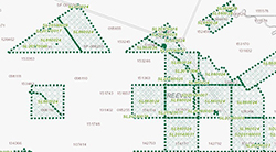
Oil and Gas Lease Sale Nominated Tracts
Tracts that have been nominated for the Oil and Gas lease sale.
Original Texas Land Survey (OTLS) - Land Grid
The Texas General Land Office (GLO) uses a land grid provided by IFS | Energy and Resources. GLO is able to display the layer in our mapping viewers but, by agreement, is not authorized to distribute the data. Please contact IFS | Energy and Resources to acquire this dataset. An alternative version of the OTLS layer was created by, and is available from, the Railroad Commission of Texas (RRC). Please note that because the Railroad Commission created this land grid, you should expect geometric and attribute differences between the two datasets.
Disclaimer: Land Survey and Well Data are derived from the IFS Tobin Grid and Well products by IFS Energy and Resources. All rights reserved. For information on licensing IFS Tobin products, contact IFS Energy and Resources at 800-365-4484 or EnR.TobinSales@IFS.com.
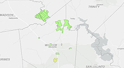
Permanent School Fund Lands
The Texas General Land Office has responsibility for the oversight and management of approximately thirteen million acres of land that has been constitutionally dedicated to the Permanent School Fund (PSF) in over two hundred Texas counties across the state. Leases on these lands are typically issued for agriculturally related uses such as farming, grazing, hunting, timber production and recreation, as well as energy exploration.
Priority Protection Habitat Areas
Priority coastal habitat areas to be protected during oil or hazardous material spills on the Texas coast. Areas were identified and prioritized by Texas Parks and Wildlife (TPWD) and GLO personnel, in cooperation with other entities.
Species and Habitats
Coastal distribution of animals, plants, and habitats potentially at risk from oil spill damage or response activities. Mapped as part of a joint project involving GLO, TPWD, and other entities.
State Agency Lands
Contains tracts identified as owned by various state agencies (universities, Department of Criminal Justice, state parks, Texas School for the Blind, and other Non-PSF lands) that have a mineral interest, whether all or in part. In-depth records research is necessary to make an actual determination of mineral status. The collection is not complete and is a work-in-progress, with periodic, but infrequent, addition of new parcels.
State Submerged Tracts with Resource Management Codes
State-owned tracts in bays and gulf waters, owned and leased by the GLO, with codes added that reflect restrictions and concerns associated with leasing of these tracts.
Three Marine League Line
Boundary between state and federal jurisdiction, located three marine leagues (approximately 10 miles) offshore in the Gulf of America.
Three Nautical Mile Line
Line of demarcation three nautical miles offshore in the Gulf of America.
Upland Surface Leases
Upland surface leases managed by the Texas General Land Office.
Contact Us
If you have a question about the Land program, find the right contact in our GLO Agency Directory
GLO AGENCY DIRECTORY