
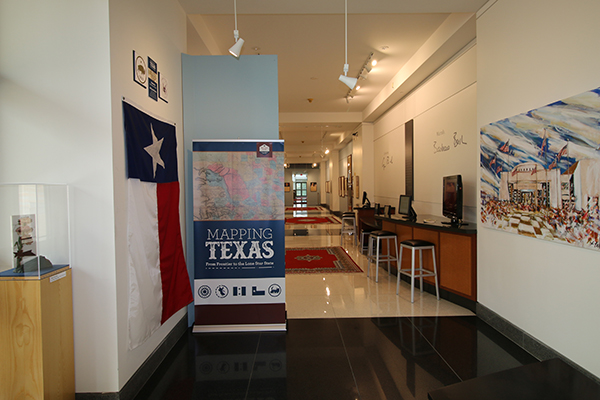
Mapping Texas: From Frontier to the Lone Star State exhibit heading to the George H.W. Bush Presidential Library & Museum
AUSTIN — Texas Land Commissioner George P. Bush is proud to announce that the Mapping Texas: From Frontier to the Lone Star State exhibit will be on display at the George H.W. Bush Presidential Library and Museum starting April 20, 2018. The exhibit features maps dating between 1513-1957. The works in this exhibition are reproductions from the archival collection of the Texas General Land Office (GLO) and Houston map collectors Frank and Carol Holcomb.
![]()
"I'm pleased to be able to partner with the George H.W. Bush Presidential Library and Museum to bring the exhibit Mapping Texas: From Frontier to the Lone Star State to College Station," said Land Commissioner George P. Bush. "This exhibit is the result of the great work of the staff of the Texas General Land Office and the Bush Presidential Library. As the custodian of the GLO's Archives, I am proud of the work we do every day to protect and share our state's rich history, but I am especially proud both personally and professionally to be able to share this magnificent collection to those visiting the library that celebrates my grandfather's legacy as a Texan and the 41st President."
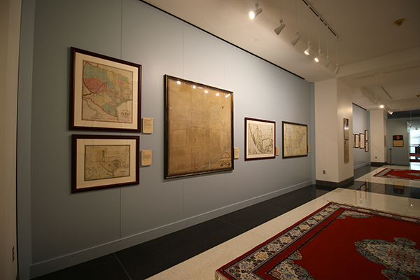
As Texas took its current shape, the space changed from an extensive, unexplored, and sparsely settled frontier under the Spanish Crown to its iconic and easily recognizable outline today. This exhibit traces the cartographic history of Texas from the sixteenth to the nineteenth century, through 26 maps and documents Mapping Texas features many of the most important, influential, and rare maps of Texas, the United States, and North America.
Some of the maps presented in this exhibit include Martin Waldseemüller's 1513 Tabula Terre Nove, one of the earliest maps of the Americas; and Alexander Von Humboldt's 1809 General Map of the Kingdom of New Spain, which was highly influential in the mapping of Texas and the American west.
Also on display are oversized maps of Texas including a copy of Stephen F. Austin's 1837 Connected Map of Austin's Colony; a one-of-a-kind manuscript map documenting the boundary between the U.S. and the Republic of Texas, when it was first surveyed in 1841, which is over 14-feet long; and many more.
About the Texas General Land Office's Save Texas History program
Created in 2004, the Save Texas History program is a statewide initiative to rally public support and private funding for the preservation and promotion of the historic maps and documents housed in the GLO Archives, and serves as a resource for teaching and digitizing Texas history. If you would like to donate to the Save Texas History program to adopt a document or collection, assist with archival acquisitions, develop educational programs, or support digital projects, please visit SaveTexasHistory.org. Follow Save Texas History on Facebook, Twitter, and YouTube.
About the George Bush Presidential Library and Museum
The mission of the George Bush Presidential Library and Museum is to preserve and make available the records and artifacts of George H. W. Bush, 41st President of the United States. We promote civic literacy and increased historical understanding of our national experience, and foster a community of public service and volunteerism. For more information visit Bush41.org.
Media contact: David Anaya, George Bush Presidential Library and Museum, at (979) 691-4069 or david.anaya@nara.gov.
###
More Press Releases